 By Mark Pfost, Public Lands Ecologist – mpfost@wisducks.org
This article originally appeared in the Wisconsin Waterfowl Association’s February 2026 Newsletter edition.

By Mark Pfost, Public Lands Ecologist – mpfost@wisducks.org
This article originally appeared in the Wisconsin Waterfowl Association’s February 2026 Newsletter edition.
A lot has happened since September 2024, when I wrote that WWA had taken on its largest project ever—we were going to partner with Necedah National Wildlife Refuge and Meadow Valley State Wildlife Area to restore wetlands in the Little Yellow River Watershed (LYR). We’re doing just that. There is not a day when my mind doesn’t end up in LYR for at least a few minutes, but since you don’t need to be similarly preoccupied, I’ll start with a short synopsis.
WWA and DNR signed an agreement about three years ago; WWA wetland ecologists were charged with searching out potential wetland restoration projects on DNR-owned or managed lands, and with DNR’s approval to carry those ideas to fruition. As I worked on other projects, I kept looking for opportunities for WWA to take on in Meadow Valley. Simultaneously, Brad Strobel, wildlife biologist for the Necedah Refuge, was having similar thoughts. He applied for (and eventually received) a grant of slightly more than a million dollars to restore wetlands on Meadow Valley. DNR biologists from Meadow Valley became collaborators. Strobel and I developed restoration plans, WWA agreed to administer grant funds, and I became WWA’s project manager for this effort.
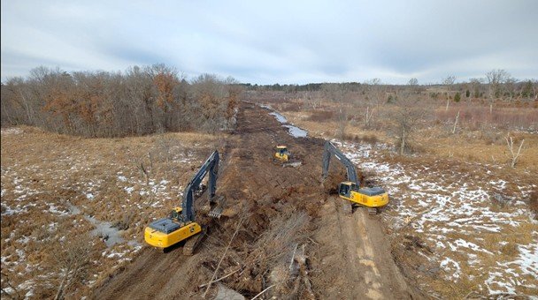
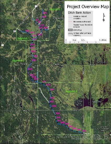
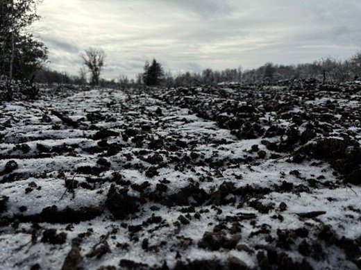
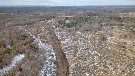
Our selected contractor, Earth Inc, completed Phase I early last March. We wrote the next scope of work last summer and again selected Earth Inc. They hauled in excavators and dozers shortly before Christmas. Phase II is composed of Segments 1-4; the first two segments form a dendritic pattern that joins at the top of Segment 3. Segments 3 and 4 are a “straight” shot south. All told, thirty-six ditch plugs will be constructed throughout six-and-one-half miles of ditch. The areas between plugs will be filled in with trees and soil from the ditch-bank spoil piles. Once finished, the elevational grades will match those of the adjacent land. As of mid-January, Segments 1 and 2 were complete. I anticipate Phase II will be finished no later than March 1st—probably sooner.
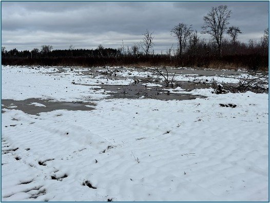
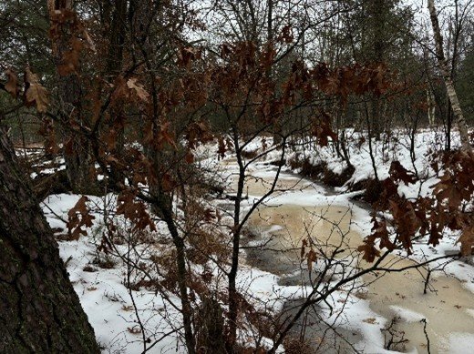
I’m on site at least once a week to see how work is progressing (Strobel also). We see clues, big and small, on how the site will respond in the coming months. Some are obvious—ditches that have been draining public wetlands since World War I are simply—gone, eradicated, erased—although the scars remain, for now. We see darker organic soils that had been buried under spoil, again exposed to sunlight, sunlight that will trigger a long-dormant wetland seed bank to re-emerge in a few months. Surface water is reappearing near now-buried ditches, seeping laterally into tangles of dead stems, brushy shrub-carrs, and desiccated sedge meadows. Springtime will partially indicate how far water has seeped. How many acres? For now, let’s say a lot—or a hell of a lot. We will eventually estimate a number, but the truth might not be truly known for years; after all, these ditches were dug sometime between Teddy Roosevelt’s and Woodrow Wilson’s administrations. It will take time for water to percolate through the soil—the wetlands will not heal overnight.


