 By Mark Pfost, Public Lands Ecologist – mpfost@wisducks.org
This article originally appeared in the Wisconsin Waterfowl Association’s May 2026 Newsletter edition.

By Mark Pfost, Public Lands Ecologist – mpfost@wisducks.org
This article originally appeared in the Wisconsin Waterfowl Association’s May 2026 Newsletter edition.
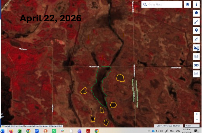
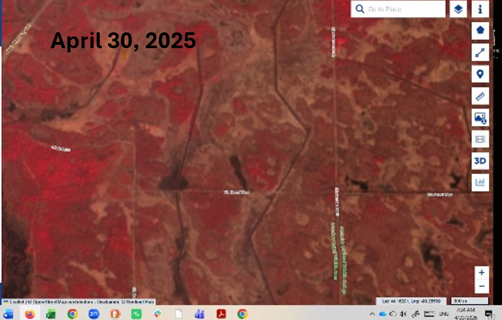
The two images below show pre-restoration on a snippet of Phase II of WWA’s Little Yellow River project, and “new” water that appeared post-restoration. Black indicates water.
Precipitation during the spring of 2025 was fairly normal, while this April had heavy rains. Even so, the effects of the restoration are apparent. The eastern-most ditch was plugged and filled; no work has been done yet on the western-most ditch. For a sense of scale, the green polygon is about 32 acres and is about 660’ at its widest point. The yellow polygons are pockets of water, suggesting that the restoration reaches beyond the ditch corridor itself.


