
This article originally appeared in Wisconsin Waterfowl Association’s May, 2023 eNewsletter.
WWA and DNR recently finalized an exciting new partnership agreement in which WWA’s new Public Lands Ecologist (PLE) staff are remotely scouring DNR properties in search of potential new wetland restoration projects. Whether you have already heard of this pending partnership or are just learning of it now, it’s a good bet that you want to know more. Where are we looking? What is the process? How is it proceeding? When do we start moving dirt? Good questions all.
In early March, WWA (Executive Director Bruce, Project Director Peter, PLE Mark, and PLE Anthony) and Jason Fleener (DNR) spent several hours discussing topics that would set the stage for partnership success. These included prioritizing geographic work areas, tracking progress of each of the many steps involved in wetland restoration, from the initial look-see to either project rejection or approval for each site examined, detailing which organization was responsible for what, and finally the project approval process. This wasn’t glamorous work, but it was necessary.
Internal WWA discussions to fine-tune processes followed; processes, forms and spreadsheets were designed, debated, and modified. Anthony, built our SharePoint infrastructure and associated spreadsheets. We’re now able to track all work and share information for Zoom call discussions. This is the guts of our effort, but no glamour yet.

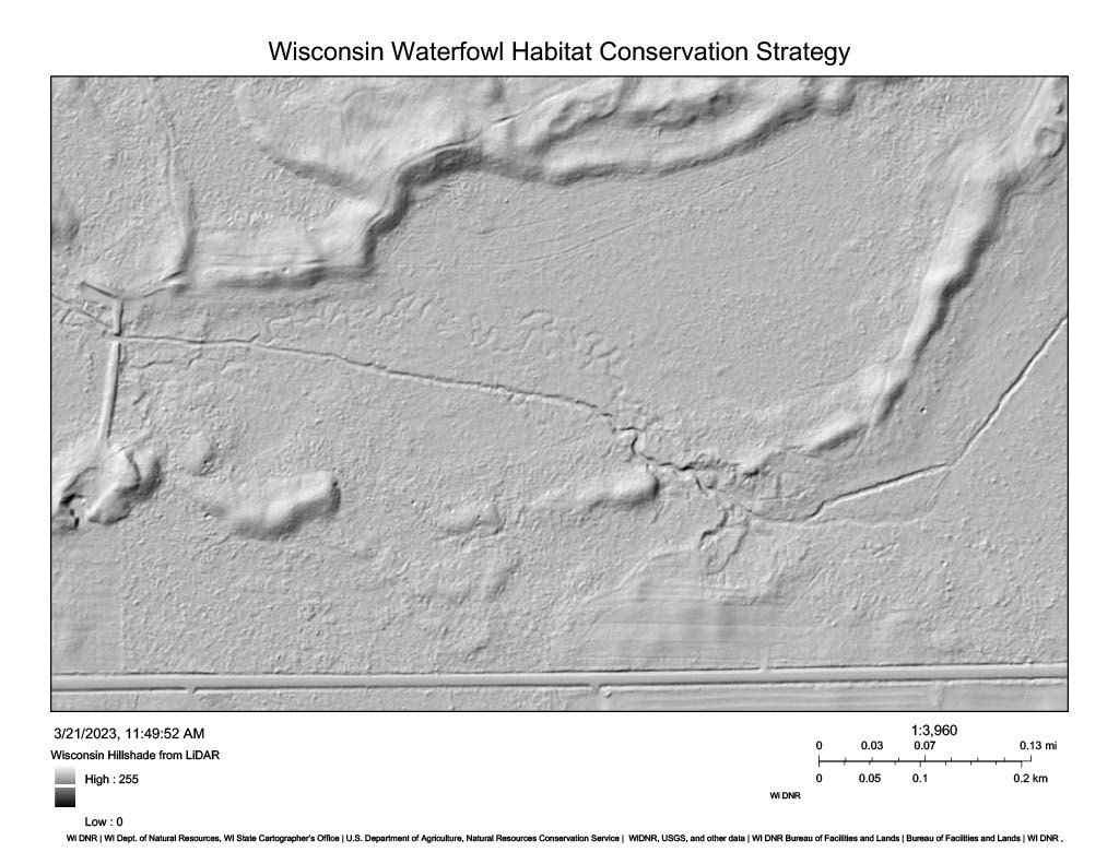
Work has not yet started on any site although project funding is secured, and Anthony and Mark have completed almost seventy initial desk reviews of sites thus far. What are they looking for and how do they conduct a typical desk review? The two are looking for altered hydrology that can be fixed – not scrapes. The “how” involves looking at a lot of maps on computer screens; depending on site, they may look at 1930’s vintage aerial maps, time sequences in Google Earth, soils maps, county maps with elevation contours, maps showing hillside LIDAR elevations, direction of water flow, and restoration potential – maybe others. They complete forms and spreadsheets with basic data such as location and acres as part of the tracking process.
While looking at all of this information, they are asking themselves questions. Is there potential? What restoration technique(s) might work here? How do these ideas square with what we know of DNR’s management goals? Will elevations of nearby private property lines preclude a project? Can we get equipment to the site? Is it worth the cost? Is the site without potential? This informs our Go/No-Go decisions and whether or not to visit the site – the beginning of the glamour. Stay tuned…